Showing posts with label Switzerland. Show all posts

Monday, 4 January 2021

Swiss Alpine Pass Route

The Swiss Alpine Pass Route runs for 200 miles  between Sargans and Montreux over 18 mountain passes. It is also called the Via Alpina 1 for the part between Sargans and Lenk.

My wife Jan and I walked it with 3 friends in two 8 day sections, the first from Grindelwald to Montreux in 2006 and the second in 2013 from Sargans to Grindelwald. Both trips were in Late August/early September.

I wrote daily blog posts at the time and have combined these, illustrated with mobile phone pictures as well as the black and white photographs that I took on my Mamiya film cameras. There's lots of other information there as well.

Here is the link to the new web page: Swiss Alpine Pass Route


Sunday, 3 May 2015

Alpine Pass Route Day 2. Weisstannen to Elm.

We had an early breakfast at 7am as it was going to be a long tough day today.
Shortly after 8am we started walking up the valley along the river. So many waterfalls! Lots of cows with very loud cow bells for company. Easy walking for a few miles then a steep climb to the pass.
View east from below Foo Pass


We reached the pass by 1.15pm. This was the main event of the day at 2223m and clear views in all directions. Took a few photos here on my Mamiya 7 camera as well as a few on my mobile phone so that I had some images for this blog post.

Foo Pass view north


Jolly steep descent from the pass and we quickly came to the Raminer farm which seemed to be selling refreshments, including beer. After a short stop for a pint we continued down to Elm,  which took a further 2 hours.

Elm is a pretty but quiet village and we stayed in the Elmer hotel and were very well looked after all night.

Tomorrow we walk to Linthal.
Foo Pass

Alpine Pass Route Day 8. Meiringen to Grindelwald

Thursday 12th was our 8th and last day walking the Alpine Pass Route. This completes this half of the route, as well as the entire walk from Sargans to Montreaux as we walked from Grindelwald to Montreaux in 2006.

We have actually been following the signs for the Via Alpina 1 this time which follows most of the same route.
The day started wet in Meiringen as we made our way up past the Reichenbach Falls, the place where Sherlock Holmes met his fate. I took several photos on my Samsung S3 phone which Google automatically converted into a video.

It was a steady climb up through the trees and meadows to Schwarzwaldalp where we stopped for a short lunch break. The rain started again before reaching the Grosse Scheidegg for another break. It was just a stroll from here for a couple of hours to our finish at the Alte Post Hotel in Grindelwald. The black and white photo is of the Wetterhorn.

Overall, we took 16 days to walk about 220 miles from Sargans to Montreux, starting in 2006 and finishing in 2013: 2 blocks of 8 days.


Alpine Pass Route Day 6. Attinghausen to Engelberg

Another long day on our 8 day walk from Sargans to Grindelwald along the Alpine Pass Route.

We had an early breakfast son that we could catch the small gondola lift from Attinghausen to Brusti before the rush.
We were walking by 8.30am and the rain was clearing with the sun trying to break through.

Nice little ridge as we climbed higher to the saddle of Angistock. Then we lost quite a bit of height as we avoided a slope prone to rockfall. Then up to the Surenen Pass at 2291m by late morning. It was cold but still dry.


We dropped down to a ski hut (about the size of a garden shed) to have lunch inside. Shortly after leaving the rain returned and continued for the rest of the day. No views or photos after this.

Stopped at hut for hot soup and a break from the rain. Then down for another hour or so to another hut for a beer. Really heavy rain for the rest of the descent. We arrived at our hotel at 5.30pm looking like drowned rats!

Tomorrow we walk to Meiringen with better weather forecast. Fingers crossed.

Friday, 6 March 2015

Crans-Montana Skiing Last Day

True to the forecast today was a fantastic day, albeit with no clouds at all.
We started skiing at the crack of 10am! I was carrying a Mamiya 7 camera, 43mm and 65mm lenses, 8 filters (just in case!), Gitzo Mountaineer 1028 tripod with Manfrotto quick release head, 7 rolls of 120 FP4 and 1 roll of 400 Delta 120 film. I used all but 2 rolls of FP4. Because it was blue sky and mostly above the tree line I used B+W light red filters all day.

I had just one shot on my list, Wildstrubel from the highest lift station of Plaine Morte. I skied to the summit in 2000 but in complete whiteout so I didn't see anything from the top. Unfortunately, the lift was shut because of strong winds, same as yesterday. Everything else was working though so we went off for a few hours finding a few photos along the way.

Patterns on the hillside

Skiing past the Violettes hut

By early afternoon we returned to the lift to the top just as they were starting to run it. What luck! It was jolly windy and very cold at the top, at just under 3000m. The view across the glacier to Wildstrubel was clear as a bell.

Wildstrubel (right) from Plaine Morte

A bit further down I could see a different angle on the shot so I skied a few hundred yards off-piste until I had a clearer view with some good wind blown snow shapes in the foreground.

Another objective was to test Ilford 400 Delta for handheld shots. I took a few handheld and some using my tripod. I also took similar photos on Ilford FP4, my usual film for the last 20 years or so. This would give me 2 stops extra speed = 2 stops faster shutter speed, 1/60 instead of 1/15, for example. This should be enough to ditch the tripod if my back was painful. At least I could then continue taking photos instead of leaving the camera at home. Now I just have to work out how to process it within my exposing and processing system.

Thursday, 5 March 2015

Crans-Montana Skiing Day 3

Yesterday we had a full day skiing, but in mostly poor weather. Lots of low cloud and flat light. Today was bright but windy. Just 5 lifts were running in the Crans-Montana ski area and by 1pm it was down to 3. Wind speeds of 115 km/hour were measured at the Violettes mid-station at 2200m. At times it felt like we were back skiing in Scotland with the icy blasts of spindrift, then I noticed there was snow under both skis and knew it couldn't be Scotland!

We finished skiing by 2pm, caught a bus back to our hotel in Montana, dropped off the skis and went for a 4 mile walk around Crans-Montana. The GPS said we had travelled 17 miles while skiing, including lifts.

Here's a couple of phone shots from our walk. The mountain one shows the spindrift being blown off the mountain tops. I didn't carry my big Mamiya 7 camera the last 2 days so I left these as colour shots as there won't be a black and white version!
Montana Lake View

Montana Mountain View

The forecast is good for tomorrow so it's a proper photo day with my Mamiya 7 camera and tripod! Fingers crossed the lifts are open.

Tuesday, 3 March 2015

Crans-Montana Skiing Day 1

What a contrast to the rain and snow of yesterday. We had a lot of sunshine for our first day skiing at Crans-Montana in Switzerland. It was actually my second time skiing the Crans-Montana area as I had a 5 day ski mountaineering trip starting above Sion in 2000. We were blown off Arpelistock, then skied the Wildhorn, Wildstrubel and Schwarzhorn, all 3000m peaks in the Western Bernese Oberland north of Crans-Montana. Our descent from the Schwarzhorn took us down to Aminona, part of the Crans-Montana ski area.

However, today we started in Crans and worked our way over towards Aminona. The skies were a little cloudy at times but continually changing. I took a couple of rolls of Ilford FP4 120, that's 20 shots, during the day.

Here's one of the Violettes Hut. I took quite a few of this on my Mamiya 7 camera and red filter as the light and clouds changed. The shot here was taken on my phone and edited with Snapseed to give you an idea of what I took on the proper camera.

I'm planning to ski without the camera tomorrow as snow forecast on and off all day.

Sunday, 1 March 2015

Jolly Wet Day in Geneva

Yesterday we flew out to Geneva and planned to take photos through the day today. Unfortunately, it rained on and off all day. I took no pictures during daylight and just 18 shots at dusk and night time. We had a lot of exercise though, walking about 15 miles around Geneva with the odd pub break during the heaviest rain.

I took this on my Mamiya 7 camera and this is the phone version to give you an idea of one of the shots.
Geneva Cathedral at Night

Catching train to Crans-Montana tomorrow. Ski photos Tuesday to Friday, weather permitting!

Monday, 21 October 2013

Wet Luxembourg, Stunning Bruges

Apologies but I'm a bit behind with my blog posts. It's been a bit busy since we returned home from the Alps, with no sign of a let-up yet.

We left Switzerland on the 17th September and had one night in Luxembourg. I had no photos of it before this trip and I now have just one! It rained pretty much the whole time except for about 30 minutes.
Luxembourg Between Showers

As soon as the rain resumed the following morning we headed straight to Bruges, about 2 hours or so away. It was sunny and bright most of the time we stayed here. The phone pictures here don't do it justice but do give you a flavour of what I took on my Mamiya 7 film camera.
Bruges


We came home on the 21st September, just in time for the last day of the Old Hall Inn beer festival in Whitehough!

Since then we have done 7 days of courses and a big 2 day event in Buxton, here's what our stand looked like.

The Great Peak District Fair


I have also run the Gallery in the Gardens in Buxton for 3 days and given 2 photographic club lectures, in Oldham and Nottingham.

I have also scanned a couple of dozen negatives from our Berlin trip in July as these were needed by Antje for the Frankfurt Book Fair a week or so ago. I will put some of these in another blog post.

It's quieting down a bit now, just 4 shows for a total of 16 days, 2 days of courses and 1 lecture in the next 3.5 weeks!

Monday, 16 September 2013

Grindelwald Wet and Dry

We are having a few days to ourselves in Grindelwald. On Friday, the first day after finishing the Alpine Pass Route on Thursday, we had a short walk with Rob to the lakes near the First lift above the village. The clouds were going up and down on the tops of the big peaks which added to the pictures, as long as you had a bit of patience!
Schreckhorn

Finsteraarhorn

This moon shot was taken on my phone as we went to dinner.


Saturday was a good day too so we returned to the waterfall below the Klausen Pass. We came past it on our 4th day on the Alpine Pass Route but the clouds were down and it was raining. Nice traditional chalets in the foreground though. It was warm and sunny on our return. It took us over 4 days to walk from the falls to Grindelwald and just 90 minutes to drive back, then a 40 minute walk.

The waterfall is called the Staubi Waterfall in the village of Asch and is 90 metres high. I took photos with chalets in the foreground and the waterfall behind. Then I climbed up the hillside to the foot of the falls. It needed a scramble to get down into the riverbed. This put lots of small waterfalls into my shot with the big fall behind. My back was too painful to get right down to where I thought the best shot was but I made the tripod go quite low where I was able to get to and it still looked good.

All the important photos were taken on my Mamiya 7 film camera so it will be a few weeks until I get to these. I forgot to take similar photos on my Samsung S3 phone to illustrate this blog. I did take one as we were leaving the village to give an idea of the beautiful setting.


We have had a couple of wet days so taking it easy with short walks and no photos.

Tomorrow we leave the mountains and head to Luxembourg for some city photos as we make our way home.

Wednesday, 11 September 2013

Alpine Pass Route Day 7. Engelberg to Meiringen

Another good start to the day. Dry but cold. Clouds on the tops though.

Started in the best way by catching the cable car to the top! Good view behind us over Trubsee Lake (lake photo taken by Jan as I forgot!). All of my photos here taken on my Samsung S3 and edited with Snapseed.

Walked past lake to another lift to Joch Pass. This resembled a building site so quickly moved on.

Fresh snow overnight above 1800m. Looked like winter. Hoped that tops would clear but stayed hidden from us.

Good views with nice skies. After the Engstlensee lake below the pass we climbed to Tannalp and on to Balmeregghorn. The weather was closing in here. Low cloud and snow.

The next section should have been spectacular. A narrow traverse up to Planplatten. The snow was falling harder and it was windy so we took the quick way down; a convenient cable car to Meiringen from 2100m!

We were down before the forecast rain and testing the local beer before reaching our very comfortable hotel.

Tomorrow, Thursday, we finish our 8 day walk in Grindelwald.

Monday, 9 September 2013

Alpine Pass Route Day 5. Unterschächen to Attinghausen.

Today started where yesterday ended, with rain and low cloud. The Hotel Alpina in Unterschächen was good and most of our clothes were dry.

The walking was not that memorable, being mostly along or close to roads.
The town of Burglen was interesting, with it's claim to fame being that it was where William Tell came from. Unfortunately it was shut! I took a few photos around the church while the rest of the group searched in vain for somewhere that was open for lunch.
Burglen church

William Tell statue in Burglen
We carried on along the river towards our hotel in Attinghausen as the skies above cleared. The Hotel Krone where we are staying is a very friendly place with good food and beer.

I also took some photos of the castle ruins near our hotel. Nice light, nice sky.

Forecast tomorrow is bad!

Alpine Pass Route Day 4. Linthal to Unterschächen

Today, our fourth day on the Alpine Pass Route, was our first wet day. It was raining as we left the Hotel Bahnhof in Linthal and it was still raining as we arrived at the Hotel Alpina in Unterschächen. The only thing that changed was the intensity.
It was a bit under 10 hours and 17 miles, with about an hour of stops through the day. We started at 8.15am.
The first few hours we climbed up through forest so we were sheltered from the rain but it was warm and humid. Not that pleasant but some stunning cliffs to weave through.
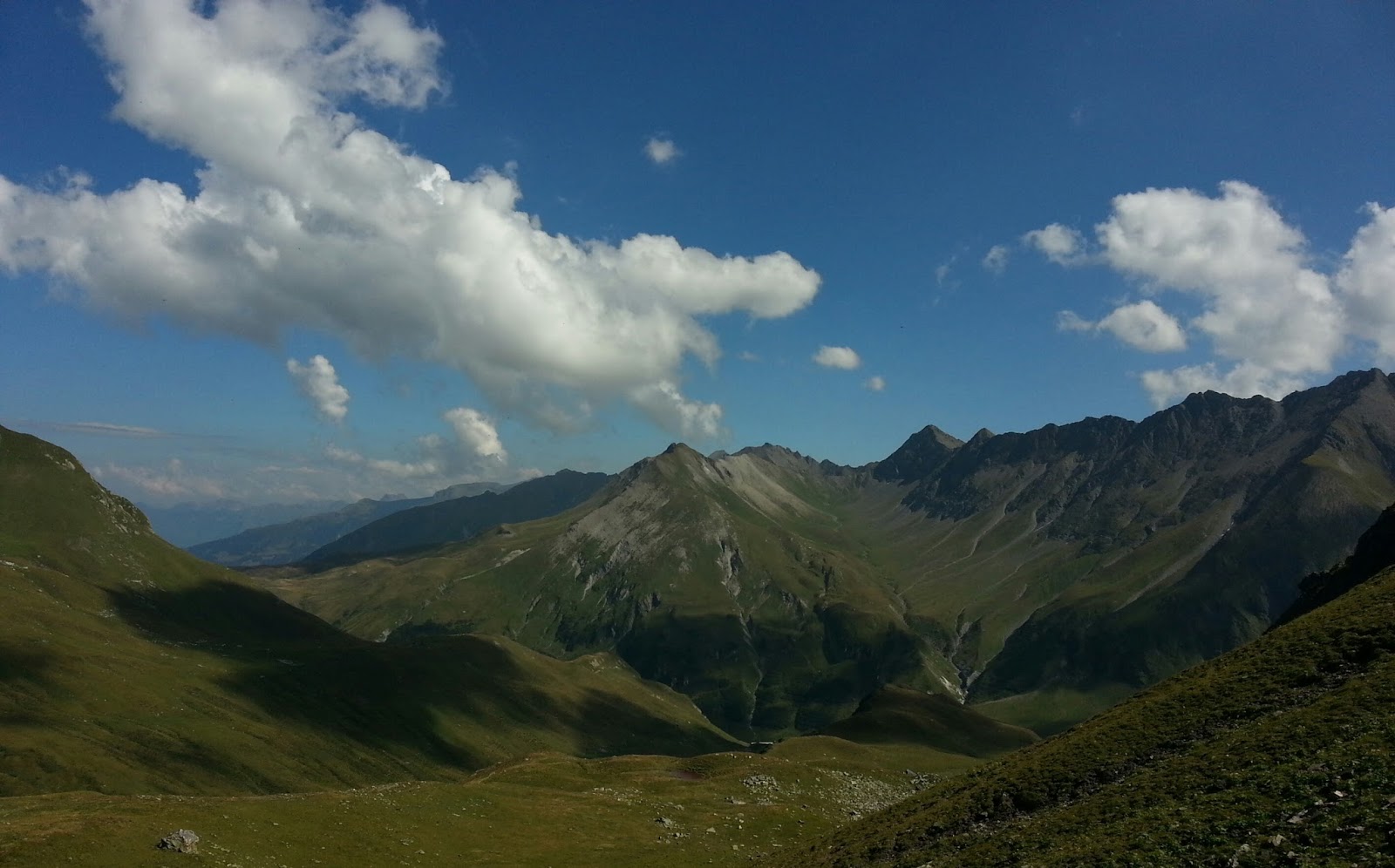
Above the forest it opened out to alpine meadows and the rain was harder. We took shelter at Urnerboden for a lunch break at 12.30. I did take a shot of Urnerboden but only on my Samsung S3.
Urnerboden


It was raining too hard for me to use my Mamiya 7 camera.
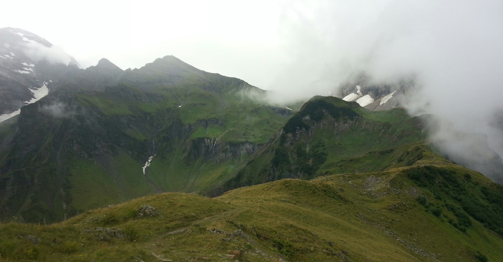
From here it was a steady climb to the Klausen Pass, where we stopped for a snack at 2.50pm. At 1900 metres we had hoped for good views but with low rain clouds we saw nothing.
After a long traverse from the pass it was steeply down on a good path to Asch. This should have been one of the highlights of the trip with a very large waterfall immediately behind the village. Unfortunately it was raining but I managed 4 shots on my Mamiya 7 camera and several on my Samsung S3. Low cloud so unable to see the top.

The version I took on my Mamiya 7, added after trek

Aesch Falls on a good day!, taken on my Mamiya 7, added after trek


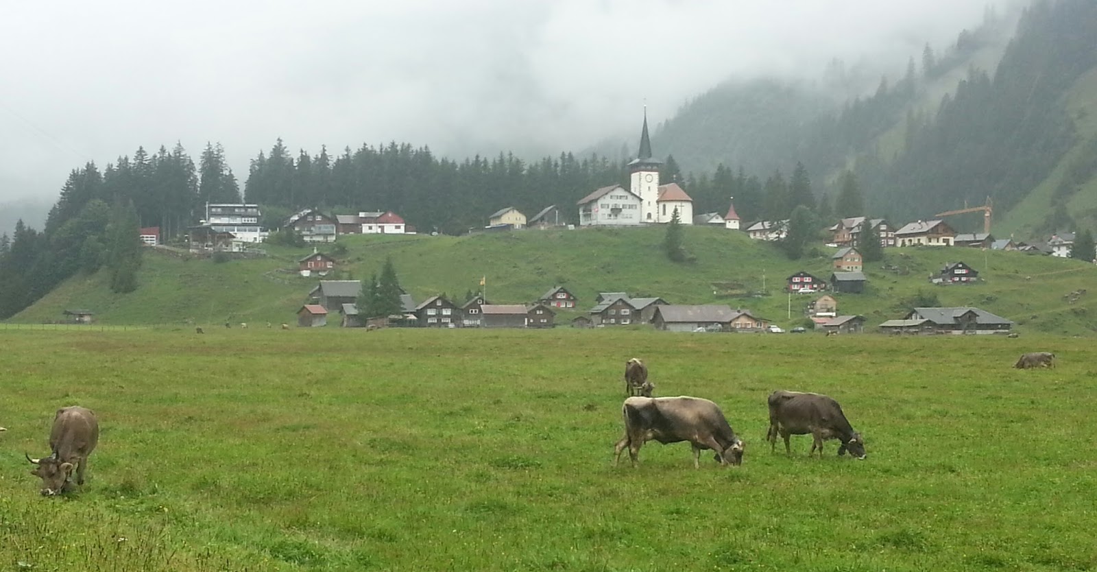
It was just an hour more to walk down to our hotel in Unterschächen, the Alpina. No wifi in the Hotel so this blog will have to wait until tomorrow, Monday, to send.

Garden gnome house near Unterschächen. 

Short day tomorrow, just 4 hours, to Attinghausen near Altdorf.

Sunday, 8 September 2013

Alpine Pass Route Day 3. Elm to Linthal.

Yesterday was a big day for us and jolly tiring so we decided to shorten today's walk by 4 miles by using the bus. The weather was due to close in later so this also gave us the best chance of decent weather for the high shots.

We were walking by 9.40am at 1700m. It was a steady climb from the Obererbs Ski hut to the first saddle at 11am. Good views and sunshine.

Richetli Pass from Saddle

Richetli Pass right on skyline


From here it was an easy downhill section to a bowl below the pass.

We were on the Richetlipass at 12.15pm. Nice light and clouds looking back. A bit hazy ahead.

View West from Richetli Pass


Steeply downhill for a long time, some of it along the top of old glacial moraines to the valley floor.

Another couple of hours saw us in Linthal at 4.30pm. Dunkel beer on draft aided recovery! That's 3 dry days running. Forecast not good for tomorrow.


Thursday, 5 September 2013

Alpine Pass Route Day 1. Sargans to Weisstannen

Yesterday we travelled from Grindelwald to Zurich where we had a couple of hours for taking photos around the city. I took photos along the river, across the lake and around the Old Town. After 2.5h I had the shots I wanted so we returned to the station and caught the train to Sargans.
We were meeting friends in the Hotel Löwen, just below the castle. Lots of catching up to do over a few pints and a few glasses of wine.

Today we resumed the Alpine Pass Route in Switzerland that we started 7 years ago when we walked from Grindelwald to Montreaux, on the shores of Lake Geneva. It's the same group of 5 walkers but unfortunately our support team has changed because of illness from good friends Rick and Glen to a commercial company, Swiss Trails. It's not the same but the bags arrived!

The whole route crosses the high alpine passes between Sargans and Montreaux
A total of 16 days walking by the time we finish this time in Grindelwald.
It was a short day today, just 7.5miles and 4 hours. Jolly warm though. Temperatures around 27ºC. Lots of walking in forest which was much cooler than open hillside. An easy introduction to the trip.


We arrived at our hotel in Weisstannen in time for lunch, I shared a Rosti with Phil and had a couple of Dunkel beers.

Weisstannen Refreshments

Tomorrow we cross the Foo Pass to Elm, a rather more serious and strenuous day than today.