Saturday 22nd February 2020
Jan drove us to Bradford (actually closer to Bingley) where we parked at our hotel and walked 4.3 miles in 1h 10mins to meet friends at the Bradford Beer Festival in Saltaire. We raced along a bit because we received a message while driving up to say the meet time had been brought forward by 30 minutes! Fortunately the route followed the canal towpath so it was flat! The beer festival was interesting, fortunately they served 1/3 pint measures, and I found several stouts and porters to try but only one stood out, Stag Brewery Knock Kneed Stag.Sunday 23rd February 2020
Left Bradford Premier Inn and briefly stopped at Greggs to pick up breakfast before driving to Penrith Premier Inn. We were too early to check in so we went for a walk around the town and a drink at the Agricultural Hotel. After checking in and dropping off our bags in our room we drove to Dockray near Aira Force. Jan parked the car near the Royal Hotel. It was dull but mostly dry with snow showers. 40mph winds at the top of Gowbarrow Fell (1579ft) make it a bit harder for the last section. It was just 3 miles in total but a good start to the week. No photos as it was very dull all afternoon. We stopped for a meal and drinks at the Dacre Horse and Farrier, a great little village pub near Pooley Bridge.Monday 24th February 2020
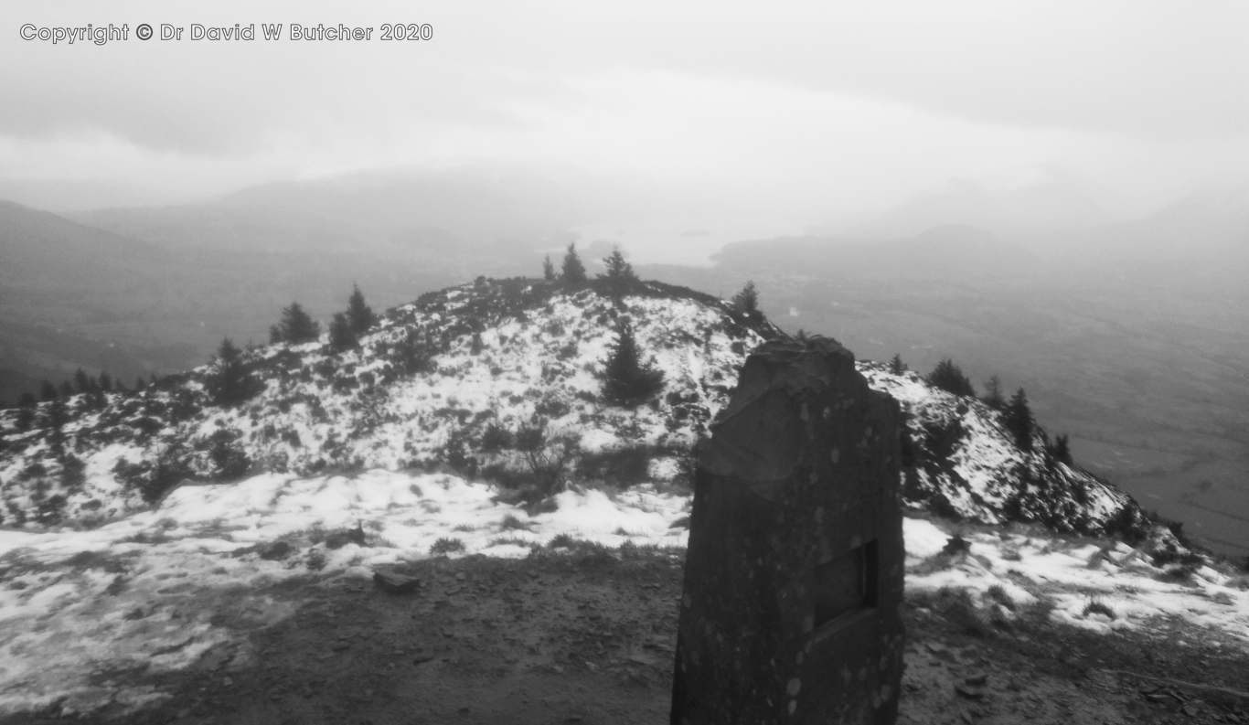
Each morning we picked up a breakfast roll each from Greggs and took it back to the hotel. There was a dusting of snow in Penrith but as we drove to Keswick it turned to rain. We parked on the edge of Keswick and walked in full waterproofs along Spoony Green Lane and up Latrigg (1203 ft/368m). It briefly stopped raining and gave us some misty views. Next we headed for Lonscale Fell (2344 ft/715m). The clouds were down so we could barely see the lower slopes from Latrigg but we pressed on. From about 600m there was about 3 inches of fresh snow. It was very wet now and unpleasant! We dropped down as quickly as we could to pick up the Cumbria Way and followed it back to the car. In total our walk was 6.8 miles. We stopped at the Threlkeld Horse and Farrier to dry out and for good food and drinks.
Latrigg Summit track near Keswick

View from Latrigg near Keswick

Derwent Water from Latrigg near Keswick
Tuesday 25th February 2020
Today there were 3 fells that stand on their own so we decided to drive to each of them and climb them separately rather than try and link them together, especially with such bad weather. We started by parking in a lay-by for 3 or 4 cars near the bottom of Little Mell Fell (1657ft/505m). It was wet, windy and cloudy on the top but it only took 13 minutes to walk to the summit cairn and 22 minutes for the round trip back to the car.
Little Mell Fell Summit trig point

Little Mell Fell Summit trig point

View from Little Mell Fell Summit, what a view!
Next we drove to the foot of Great Mell Fell (1760ft/537m). Once again there was parking for a few cars at the foot of the hill. It was a bit brighter for most of this walk, just the odd wintry shower. Good view from the top to the neighbouring Little Mell Fell. We were there and back in an hour.

Next we drove to the foot of Great Mell Fell (1760ft/537m). Once again there was parking for a few cars at the foot of the hill. It was a bit brighter for most of this walk, just the odd wintry shower. Good view from the top to the neighbouring Little Mell Fell. We were there and back in an hour.

Great Mell Fell View to Little Mell Fell

Great Mell Fell View
It was a little further to reach the next peak. Jan drove us north of Mungrisdale and Mosedale to the foot of Carrock Fell (2174ft/663m). It started off with an easy path traversing the hillside which then led into a steep ascent up a wide gully covered in wet snow and was very slippery. Above this we had snowy slopes to the top. Again, it was bad weather with rain, wind and hail and wet slippery snow to walk up. We returned to our hotel to shower and put dry clothes on (even with good waterproofs the rain gets in the front of the waterproof around our faces and dribbles up our sleeves as we use trekking poles). We headed back to the Agricultural Hotel for our evening meal and drinks.
It was a little further to reach the next peak. Jan drove us north of Mungrisdale and Mosedale to the foot of Carrock Fell (2174ft/663m). It started off with an easy path traversing the hillside which then led into a steep ascent up a wide gully covered in wet snow and was very slippery. Above this we had snowy slopes to the top. Again, it was bad weather with rain, wind and hail and wet slippery snow to walk up. We returned to our hotel to shower and put dry clothes on (even with good waterproofs the rain gets in the front of the waterproof around our faces and dribbles up our sleeves as we use trekking poles). We headed back to the Agricultural Hotel for our evening meal and drinks.


Carrock Hill Summit Cairn

Carrock Hill Summit View

Carrock Hill Summit View

Carrock Hill Descent View
Wednesday 26th February 2020
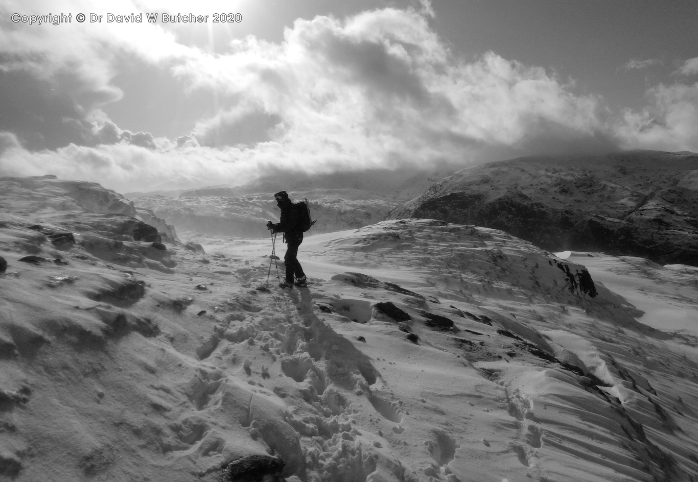
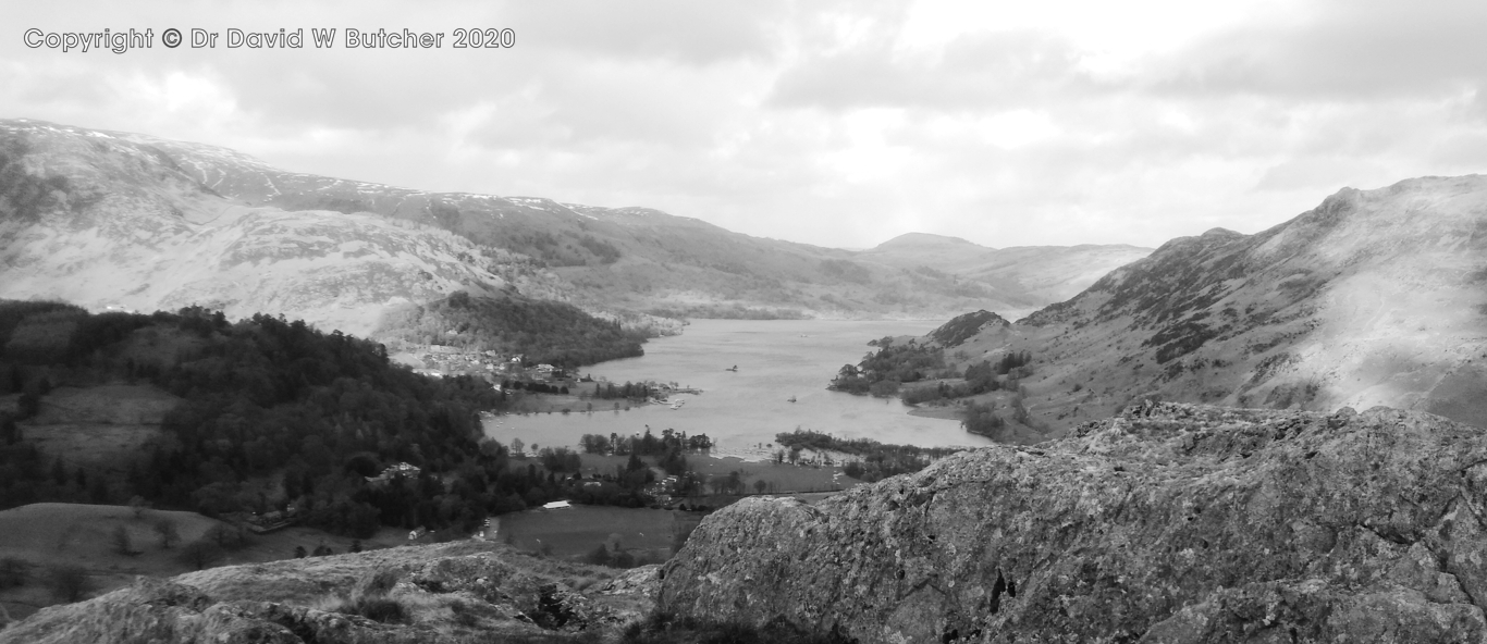
What a change - a blue sky day! We drove to the Howtown St Peter's church car park. Lots of spaces to park on both sides of the road. We walked around the end of Steel Knotts to Martindale and then across to the other side of the valley and up to Winter Crag. From here it was an easy walk on a footpath over rocky outcrops and grass to the top of Beda Fell (1664ft/509m). We had good clear views mostly but the wind was remarkably strong considering the relatively low height of Beda Fell! The wind measured over 50mph on way up.
Angletarn Pikes and Beda Fell near Howtown

Angletarn Pikes and Beda Fell near Howtown

View near Howtown St Peter's Church


View to Arthur's Pike, Bonscale Pike and Steel Knotts from Beda Fell - colour version


View from Beda Fell Lower Slopes to Place Fell, near Howtown

From the very windy top of Beda Fell we followed the ridge down to a dry stone wall and then down to the road. After crossing over the river bridge we headed straight up Hallin Fell (1271ft/388m) hillside on a reasonable footpath not marked on my maps. There were great views from the top, including to Helvellyn, and it wasn't as windy as Beda Fell! We started down and the view to Helvellyn cleared a bit so I returned to the top to take some more shots. Then it was down to the car. I carried my Mamiya 7 camera and 65mm lens and shot 3 rolls of Ilford 400 Delta 120 film, all hand held, no tripod.


Helvellyn Range and Ullswater from Hallin Fell near Howtown taken on my Mamiya 7 camera and Ilford 400 Delta 120 film

Angletarn Pikes and Place Fell from Hallin Fell near Howtown


We called in to the Howtown Hotel Walkers Bar (at the back) but it was closed for refurbishment.

We drove along to Pooley Bridge Sun Inn for a drink, it was about 2pm and just starting to rain. The best of the weather had gone for the day. I had a chat with the Barman lamenting the demise of Jennings Sneck Lifter beer.

Then it was back to Penrith for a quick change and out to Wetherspoon's for a quick meal then to the Fell Bar for beer.
Thursday 27th February 2020
It was a nice day so we changed our plans and climbed Helvellyn so that I could take some new winter shots from the top. Jan drove us to the Wythburn car park. This is very expensive car park, £7 for over 4 hours! We walked up the snow-covered path to Helvellyn (3118ft/949m). There were strong winds up to 34mph on top whipping snow up into the air continuously, we couldn't get out of it for a moment. We had to put crampons on at the top as there was a lot of ice but didn't need them on the way up as there was soft snow up to knee deep. They were helpful on the way down to stop slips, didn't need our ice axes at all though even though we carried them, trekking poles were enough.I carried one of my Mamiya 7 cameras, 43mm lens, 80mm lens and Ilford 400 Delta 120 and Ilford 100 Delta 120 film as well as my smallest Gitzo Mountaineer tripod. There was good snow cover and sunny patches coming through every now and then. I set myself up at the top of the exit from Striding Edge onto the plateau. Unfortunately, I could only expose 1 roll of 400 Delta 120 film. I took some photos of Striding Edge but nothing else. I tried to reload but there was too much spindrift and I also couldn't open the camera back as it was frozen shut, this has never happened before in 27 years of using Mamiya 6 and Mamiya 7 cameras. So I had to make do with 1 roll and 10 exposures. My Gitzo tripod worked fine though even though it was about -15C with the wind chill! I took a few phone photos on the way down once we were below the windy section up high.

It was a good day but disappointing from the photo side, a lot of effort for just 10 shots but hopefully 1 of them will be a winner! We returned to Penrith for a meal at the Raj Indian restaurant followed by drinks at the Fell Bar.
 Helvellyn Snowy Descent
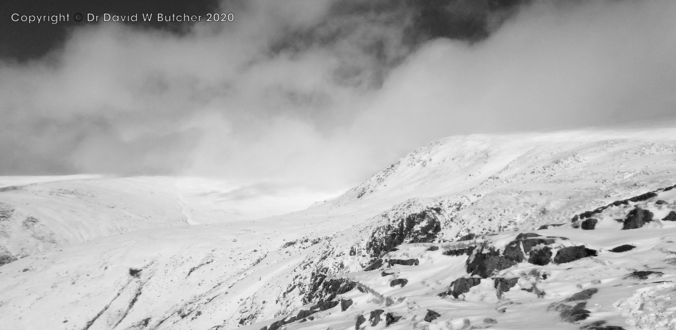 Helvellyn from Wythburn Path
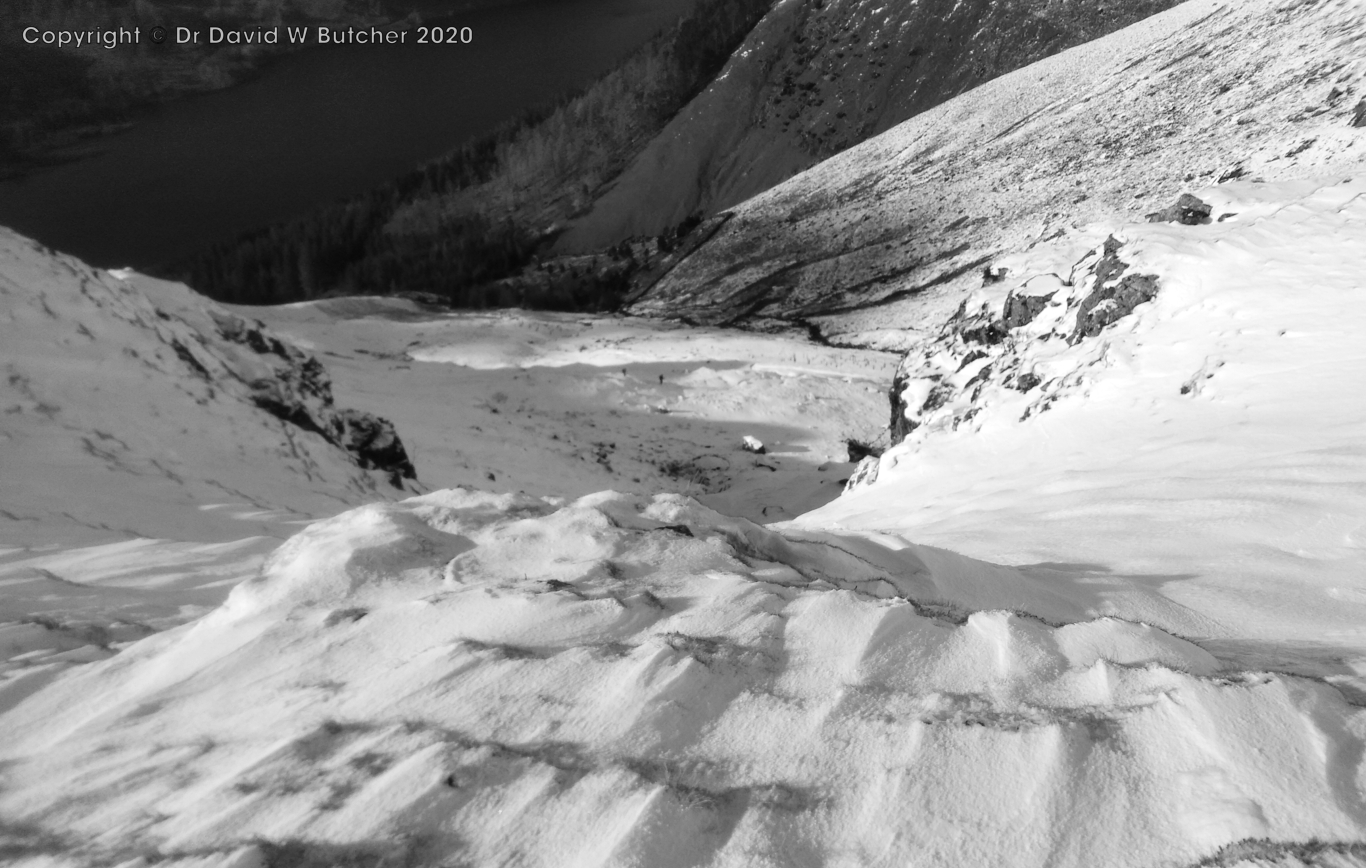 View down Helvellyn Wythburn Path to Thirlmere Reservoir
 Thirlmere Reservoir from Helvellyn Wythburn Path
Binsey Wind Speed
From here we went a few miles down the road to Dodd Wood. We were headed for the small hill called Dodd (1612ft/502m. Most of the route was through established forestry land so it was well protected from the weather. It was about 3.6 miles and took about 1.5h. Just a light breeze, even on the summit, but very wet. I took my phone photos without taking it out of the waterproof plastic case so they're not as sharp as they should have been. Back in Penrith we had a meal at the Agricultural Hotel before heading to the Fell Bar to round off the evening.
 Dodd Summit View Over Derwent Water taken through waterproof case plastic
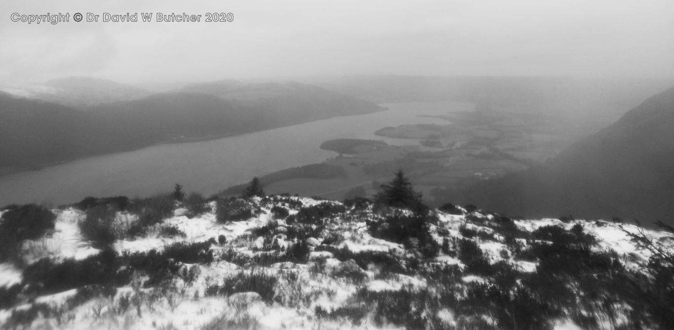 Dodd Summit View Over Bassenthwaite Lake taken through waterproof case plastic
 Ullswater from lower slopes of Birks
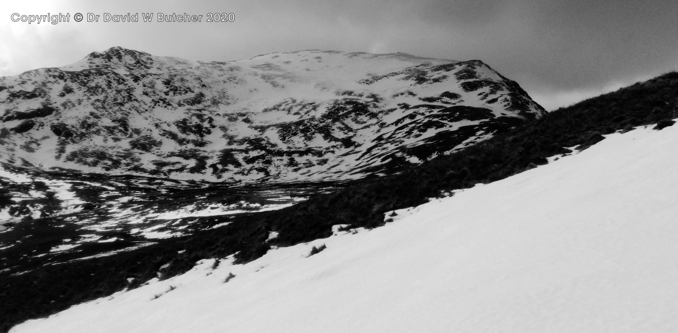 St Sunday Crag from Birks
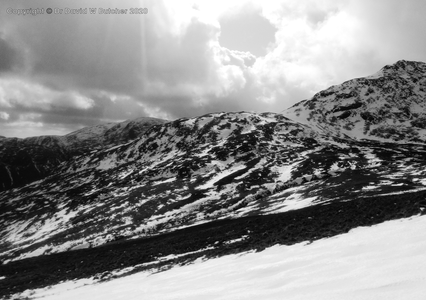 St Sunday Crag from Birks
Today it was a bit windy and there were a few patches of deep crusted snow to cross. St Sunday Crag had a lot more snow ahead but we didn't need to climb that as we were just doing a short circular walk taking in Arnison Crag (1424ft/433m) on the way down from Birks. It was very windy on top of the crags, well over 30 mph. From here we just followed the wall down and headed for the bar in the Patterdale Hotel. Then it was back to Penrith for a meal at the Raj and a pint or two at the Fell Bar.
 Ullswater from Arnison Crag
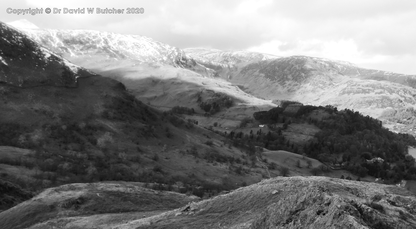 View towards Catstycam and Birkhouse Moor from Arnison Crag
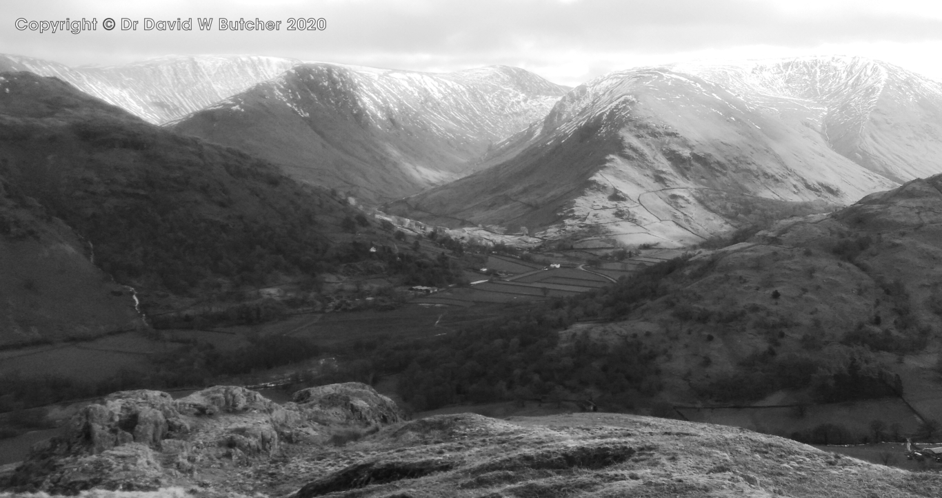 High Street Range from Arnison Crag
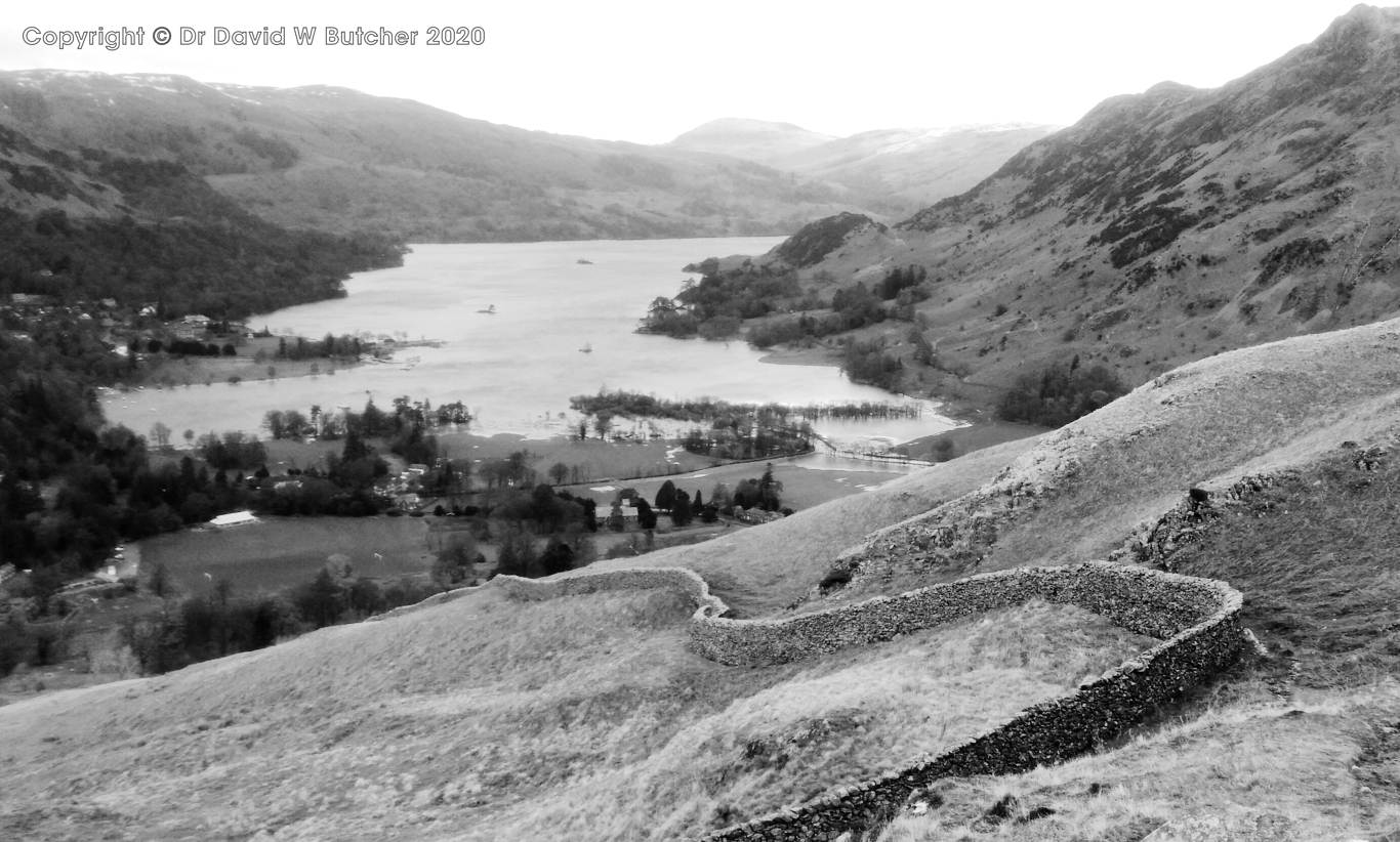 Ullswater from Arnison Crag descent
Overall the peaks we chose to climb/walk may seem a bit odd, mostly being little more than small individual hills but, having completed the Munro's in Scotland in 1996, I'm now working my way through the Wainwright's in the Lake District. Just 80 left of the 214 total. On this trip 11 of the 13 peaks I hadn't been up before and they were relatively simple to do in rain, hail, snow and very windy winter conditions. Helvellyn was a bonus day just for photography as I've been up it several times before and probably more in the winter than at other times of year.
I also carried my Mamiya 7 camera and Ilford 400 Delta 120 film on Wednesday 26th (3 rolls taken with 65mm lens only) and Thursday 27th February (1 roll taken with 43mm lens although 80mm lens also carried). I used a B+W Orange filter for all shots to darken whatever blue sky was present and add contrast to the skies. I carried my Gitzo Mountaineer series 0 tripod (with Manfrotto quick release head), total weight just over 1kg, on Thursday 27th. Unfortunately, I was only able to run off 1 roll of 10 exposures as the weather prevented me changing films. Perhaps I should have carried an emergency shelter as well so that I could have escaped from the weather long enough to do the change.
Helvellyn Snowy Descent Helvellyn from Wythburn Path View down Helvellyn Wythburn Path to Thirlmere Reservoir Thirlmere Reservoir from Helvellyn Wythburn PathFriday 28th February 2020
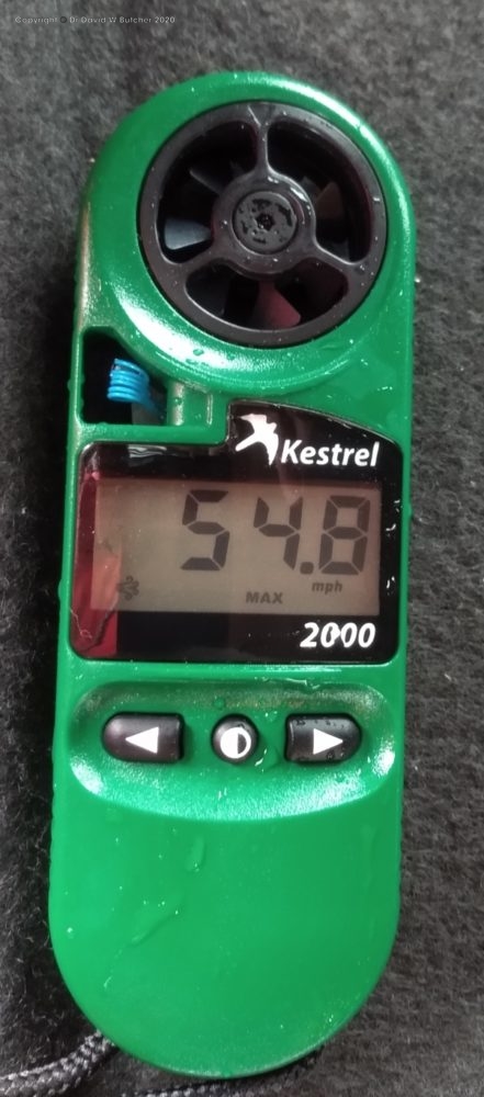
Just low peaks today as weather bad. Heavy rain and strong winds. We parked near Binsey Lodge in the Northwest Lakes and headed up a nice grassy track to the summit trig point of Binsey (1466ft/447m). Very wet, very windy. My wind meter registered 54.8 mph at top, and that was sustained, not a gust! It was like a wind tunnel. It took a bit under 20 minutes to reach the top and it was about 1.8 miles round trip. No photos.Binsey Wind Speed
From here we went a few miles down the road to Dodd Wood. We were headed for the small hill called Dodd (1612ft/502m. Most of the route was through established forestry land so it was well protected from the weather. It was about 3.6 miles and took about 1.5h. Just a light breeze, even on the summit, but very wet. I took my phone photos without taking it out of the waterproof plastic case so they're not as sharp as they should have been. Back in Penrith we had a meal at the Agricultural Hotel before heading to the Fell Bar to round off the evening.
Dodd Summit View Over Derwent Water taken through waterproof case plastic Dodd Summit View Over Bassenthwaite Lake taken through waterproof case plasticSaturday 29th February 2020
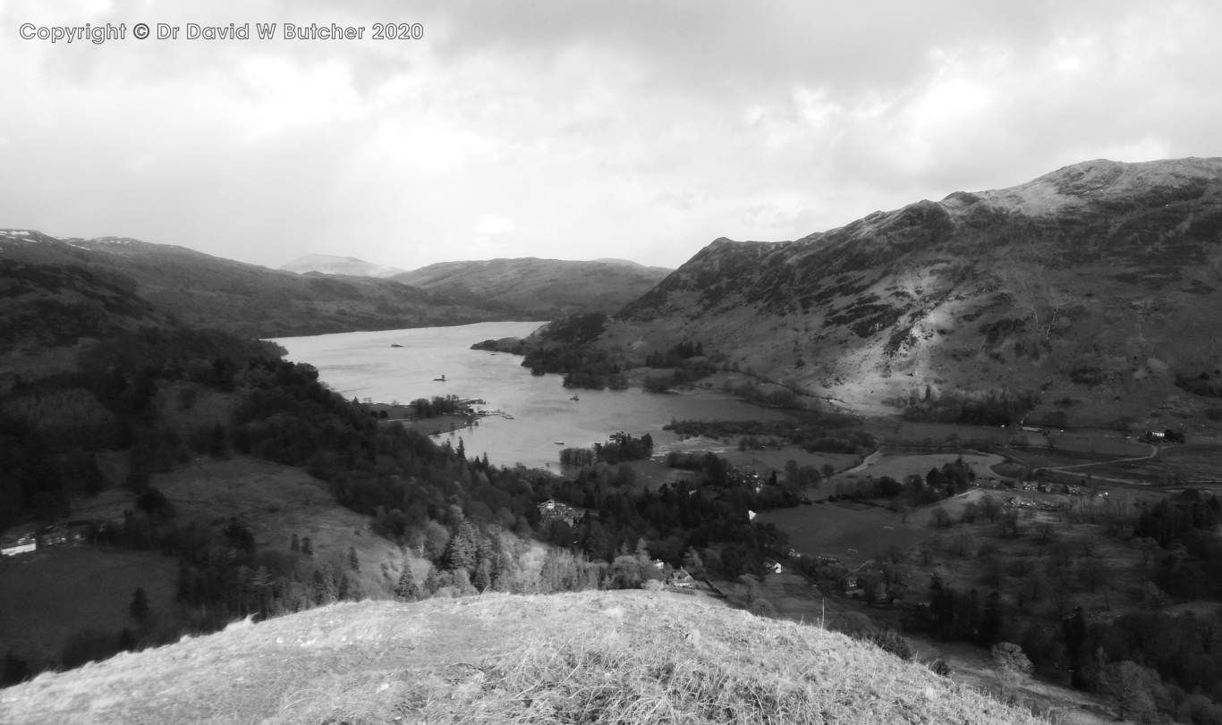
Our last walking day. We drove to Patterdale and parked in the hotel car park for £4.50. There was lots of flooding at this south end of Ullswater with the road across to the camp site on the other side well under water. We walked past the side of the hotel to the footpath at the back and followed this across meadows on a reasonable path before turning uphill through a few trees to the open hillside. We followed the ridge up to the top of Birks (2040ft/622m), a largely nondescript lump on the end of the St Sunday Crag ridge. I'd been here before on the way down to Patterdale on Wainwright's Coast to Coast (just a slight detour!). Ullswater from lower slopes of Birks St Sunday Crag from Birks St Sunday Crag from BirksToday it was a bit windy and there were a few patches of deep crusted snow to cross. St Sunday Crag had a lot more snow ahead but we didn't need to climb that as we were just doing a short circular walk taking in Arnison Crag (1424ft/433m) on the way down from Birks. It was very windy on top of the crags, well over 30 mph. From here we just followed the wall down and headed for the bar in the Patterdale Hotel. Then it was back to Penrith for a meal at the Raj and a pint or two at the Fell Bar.
Ullswater from Arnison Crag View towards Catstycam and Birkhouse Moor from Arnison Crag High Street Range from Arnison Crag Ullswater from Arnison Crag descentOverall the peaks we chose to climb/walk may seem a bit odd, mostly being little more than small individual hills but, having completed the Munro's in Scotland in 1996, I'm now working my way through the Wainwright's in the Lake District. Just 80 left of the 214 total. On this trip 11 of the 13 peaks I hadn't been up before and they were relatively simple to do in rain, hail, snow and very windy winter conditions. Helvellyn was a bonus day just for photography as I've been up it several times before and probably more in the winter than at other times of year.
Photography
All photos in this blog post were taken with my Motorola One mobile phone.I also carried my Mamiya 7 camera and Ilford 400 Delta 120 film on Wednesday 26th (3 rolls taken with 65mm lens only) and Thursday 27th February (1 roll taken with 43mm lens although 80mm lens also carried). I used a B+W Orange filter for all shots to darken whatever blue sky was present and add contrast to the skies. I carried my Gitzo Mountaineer series 0 tripod (with Manfrotto quick release head), total weight just over 1kg, on Thursday 27th. Unfortunately, I was only able to run off 1 roll of 10 exposures as the weather prevented me changing films. Perhaps I should have carried an emergency shelter as well so that I could have escaped from the weather long enough to do the change.
Best pubs
- Horse and Farrier in Dacre for good food and several local real ales. Very welcoming and friendly staff.
- Horse and Farrier in Threlkeld. A very welcoming and friendly pub that I've stayed in several times.
The food is good and Jennings beers but no Sneck Lifter (one of my favourites but Jennings discontinued it in September 2019). Obviously my 2 trips a year to the Lakes weren't enough to keep the sales high enough. - Fell Bar in Penrith (one of the tap rooms for Fell Brewery). The best beer selection of all with 6 real ales and 8 keg beers covering a wide range of styles. We called in here most evenings for the odd pint. Friendly locals to chat to as well. No food but a good Indian restaurant, the Raj, just down the road.