Introduction
The Southern Upland Way is Scotland's official Coast to Coast Trail from Portpatrick in Dumfries and Galloway on the west coast, through the Scottish Borders, to Cockburnpath in Berwickshire near the east coast. It was 218 miles long and took 15 days in two parts - 12 days in April and 3 days in September 2023.
Mostly I walked it on my own with my wife Jan dropping me off in the morning and picking me up in the evening. Some days Jan walked with me in the morning for a few miles then turned back to the car so that she could pick me up later. The official website is run by Dumfries and Galloway Council.
I'm a professional photographer and darkroom printer working exclusively in black and white using traditional film as well as traditional printing methods.
I decided not to carry my heavy camera equipment for this trip as I also have a chronic back condition. Just using a small, light digital camera was the compromise I decided upon, hence all the colour photos in this post.
I also took Naproxen every day after breakfast because I've found over the years that taking it before the pain starts reduces the pain or stops it completely. Taking it after the pain has built up does nothing.
Day 1 Saturday 15th April 2023
Portpatrick to Castle Kennedy 14.4 miles 6.2h
Jan parked us near the public toilets at the end of Portpatrick Harbour.
There weren’t many cars about at 9.30am on a Saturday.
As soon as I got out of the car I could see birds flying over the harbour water heading into the harbour walls, they were Black Guillemots, lots of them and they were nesting.
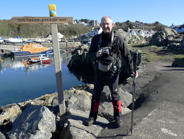
I loaded up the Mamiya 7 Camera with Ilford 400 Delta 120 film and headed around the harbour for some photos. There’s a new Southern Upland Way finger post at the far end of the harbour from where we parked, pointing to the start which is by the toilets. It was warm and sunny 12°C with a cold wind.
Portpatrick deserted car park near start 9.30am
Portpatrick Harbour Black Guillemots
Portpatrick Harbour
Portpatrick Harbour
Portpatrick Harbour
Portpatrick Harbour
Dave Butcher at Portpatrick Harbour
Southern Upland Way Starting Point 10.05am
I started from the information panel at the start at 10.05am and immediately walked up the shallow stone steps to the cliff path at the top.
There were good views over the harbour from the top.
Portpatrick Harbour from top of steps
Then there’s a good track to follow to the sandy cove of Port Mora.
There was a waterfall over a cave entrance - Ouchtriemakain Cave
The path led to the beach.
Ouchtriemakain Waterfall
The first undersea telephone cable between Scotland and Ireland was laid in 1852 between Port Kale and Donaghadee 27 miles away on the Irish coast.
Old cable house
The old cable house is a double octagonal building on the edge of the Port Kale cove.
Old cable house
View back to Port Kale
View back to Port Kale 11.10am
Killantringan Lighthouse 11.20am
Killantringan Lighthouse 11.30am
The Killantringan Lighthouse, 11.40am 3.2 miles
Jan turned back here and took my heavy Mamiya 7 camera and my fleece jacket that I didn’t need.
Road leaving Killantringan - wind farm country 12.15pm
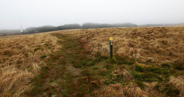
There was an information board near Knockquhassen about hidden treasure, Ultreia signs, Kists and Waymerks.
I hadn’t seen anything like this before on the treks that I’ve done previously, and I’ve done a lot of them!
There are 13 art installations along the trail marking a Kist containing coins unique to that Kist.
Before and after most of the Kists are small metal plates on the way posts with the word Ultreia.
This is the only clue given to the location of each Kist.
I found 10 Kists on my trek but returned and found another 2 a year later.
One wasn’t on my route on Day 4 as I used the alternative route which missed it.
There’s a leaflet shown below that shows the information more clearly.
New Hoard / Treasure / Ultreia Leaflet page 1
New Hoard / Treasure / Ultreia Leaflet page 2
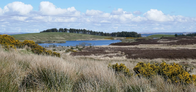
View from Mulloch Hill and Knockquhassen Reservoir 1pm
View from Mulloch Hill 1pm
I stopped for 10 minutes for a bite to eat from 1pm just below the hilltop before walking along the path parallel to the reservoir.
It was a bit like walking through a nature reserve with so many birds flying around, calling and singing.
Knockquhassen Reservoir 1.05pm
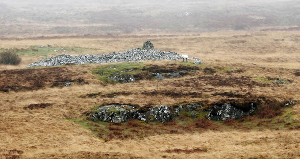
Kist 1
I spotted the kist from the path at 1.25pm but didn’t realise what it was as I wasn’t familiar with the hoard until seeing the information board a little way before it.
The Waymerks were in a glass jar to protect them from the elements but quite a few were rusty.
The first Ultreia sign that I spotted was on an uprooted post after I’d found the first Kist.
I reached Pilanton Burn, which appeared to be a fishery, at 2pm it was 8.7 miles from Portpatrick.
Pilanton Burn information 2pm
Then it was on towards Stranraer with views over the town, sea beyond and ferries coming and going at 2.20pm.
Stranraer 2.20pm
A country lane bypassed the town and took me down to the busy A77 and after crossing found the Culreoch World War 2 gun emplacements ruins, not a lot to see as what’s left is quite overgrown!
Culreoch World War 2 gun emplacements ruins 3.05pm
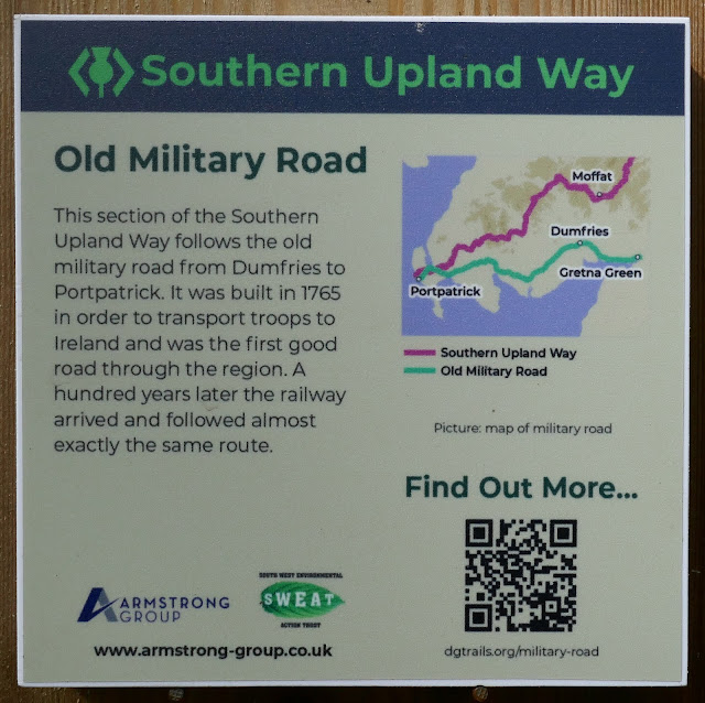
After this I followed a short section of the old military road, through a wood behind some houses to a road where I ended the day in Castle Kennedy.
Castle Kennedy Information
Castle Kennedy Pick-up 4.15pm
Jan was waiting for me opposite the entrance to Castle Kennedy House, I finished at 4.15pm 14.4 miles.
Day 2 Sunday 16th April 2023
Castle Kennedy to Balmurrie 11.2 miles 4.8h
Road from Balmurrie at junction with New Luce road in the rain 10.30am
After the road junction there was a bit more tarmac single track road before the route took off across a few fields. These were invariably occupied by quite large herds of cattle which seemed to congregate around the stiles. Fortunately, they quickly moved off with one group in particular using the track I needed as if they knew the way! This part of the route was very muddy, as in deep mud and lots of it.
Visibility was very poor so I didn’t see the Caves of Kilhern a few hundred metres off route or Cruise Back Fell Iron Age Hill Fort just off route too. However, I photographed the info boards which showed what I missed.
Near Cruise Back Fell - not a lot of features to see on a day like this
Kist 2
Just where the path turns across the slope of the hillside I came across a post with the Ultreia plate on it so it was time to keep an eye out for Kist 2. This must be the easiest one of them all to find as it's just a couple of feet from the trail with bits of rag hanging from tree branches and some wooden boxes on the ground being the Kist.Kist 2 at the Clootie Tree
The Clootie Tree and rags were part of an old Celtic custom. The Kist was a lidded box set into the ground. When I arrived at 12.40pm a young woman was brewing a cup of tea on it so I never saw inside the box but she told me it was empty. One Waymerk to be claimed later.As I came out of the woods the route followed a wall on one side and the forest on the other and it was a very wet track in places as I plodded along.
At the road at 1.50pm there was an information sign about the Standing Stones of Glenterrow but it wasn’t the weather for diverting to have a look. There was also an information board about alternative routes for the SUW and a few day walks, as if the SUW wasn't enough!
At Castle Kennedy park I followed the road past 2 large lochs, through the gates at the other end.
Then just the last few yards to Jan and our car at 2.50pm. It was just over 11 miles from Balmurrie.
Day 3 Monday 17th April 2023
Balmurrie to Bargrennan 17.1 miles 7h
I was dropped off at Balmurrie Farm wearing full waterproofs as it was a wet start to the day at 9.45am.
Balmurrie 9.45am
There's a bit of farm track before the route turns off across the moor past the Neolithic Cairn Na Gath which I didn't divert to considering the poor weather - I was walking in low cloud and could just see it a couple of hundred yards away.
Shortly after this there was another information board about the use of the land but it needs a good clean or replacing so that it can be easily read.
Before reaching the forest I had my first view of the turbines that make up a huge wind farm. They were barely visible in the low clouds but made quite a noise to let you know they were there even when you couldn't see them. Then it was into the woods on a well surfaced, well marked track.
First Wind Turbine View 10.25am
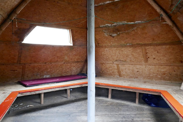
At 11.15am and just under 4 miles from Balmurrie I reached the Beehive Bothy, a really interesting shape and interior for a bothy.
Beehive Bothy Views
Soon after the bothy the Laggangairn Stones were passed in a small clearing in the forest.
Laggarngarn Stones 11.25am
A few minutes further on, on the other side of one of the major forest roads, the route was almost completely blocked by a fallen tree. You needed to be a bit of a contortionist or limbo dancer to weave through the branches to the track on the other side, not great for my bad back!
The Limbo Tree 11.35am
At the Wells O’ the Rees junction the track was mostly above the forest into bracken and grass covered hillside.
Wells O’ the Rees Junction 11.50am
The summit of Criag Airie Fell was well above the tree line and had good views over the forest, Loch Derry and wind farms in every direction.
Craig Airie Summit View North 12.25pm
Craig Airie Summit View East Over Loch Derry 12.25pm
Craig Airie Summit View South 12.25pm
Forest Track Below Craig Airie 12.40pm
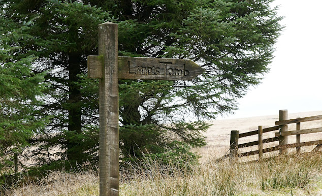
I passed the path to Linn's Tomb and stopped for a bite to eat near Derry Farm at 1pm. It was brightening up so I took my waterproofs off and packed them away.
Path to Linn’s Tomb 12.50pm
Lunch stop near Derry Farm 1.10pm
A good forest road led to a proper tarmac road just before Darloskine Bridge, this was about half an hour from my lunch stop.
Just before Darloskine Bridge
Darloskine Bridge 1.45pm
There was a good single track road so about 40 minutes later I was walking through the hamlet of Knowe and there was even a bit of blue sky showing through!
A track then cut the corner off through some woods and across fields to rejoin the road near Glenruther Lodge.
Path leaving Knowe 2.40pm
After a short section of road the trail strikes uphill to Ochiltree Hill, at 184m it's not that high but it has uninterrupted views in every direction, hence the Ordnance Survey trig point on the summit.
Ochiltree Hill 3.40pm
Ochiltree Hill 3.40pm
A bit lower down just before rejoining the road near Garchew there was another herd of cattle and the ground was really churned up and boggy.
Garchew Cows 4.15pm
Finally the trail soon left the tarmac for more fields and rough pastures to come out on the road just south of Bargrennan. From here it was just 10 minutes to the car park of the House O' Hill Hotel, reaching it at 4.50pm, where I was hoping to have a drink. Unfortunately, it has very limited opening hours on just a few days a week and was shut.
Bargrennan House O' Hill Hotel
Jan met me in the car, parked opposite the Hotel. It was 17.1 miles and took 7 hours on a day that started cold and damp and finished as a warmish sunny day.
Day 4 Tuesday 18th April 2023
Bargrennan to Craigenbay 16 miles 6.4h
Parking at Craigenbay is limited and remote so Jan dropped me off here in the morning and I walked back to Bargrennan where there's lots of parking near the pub.
Craigenbay drop-off 9.25am
Forestry Track for almost 4 miles to the river bridge 10.10am
View from Forestry Track 10.10am
Forestry Track Junction to River Bridge 10.35am
View from bridge over river 10.35am
The forestry track then climbed and followed round to Loch Dee, surrounded by some big hills.
View West Over Loch Dee 10.50am
National Cycle Network Signpost and Loch Dee about 6 miles from Craigenbay 11.30am
View Over Loch Dee to Northeast hills 11.35am
The path climbed uphill for a short section and came to a very large carved stone - The Giant Axe Head Sculpture.
The Giant Axe Head Sculpture Overlooking Loch Dee 11.45am
At Glenhead there were lots of forestry signs saying the path ahead was closed - find another route. No alternative route was offered so I ignored the sign and continued and met lots of walkers and cyclists coming the other way. We had all ignored path closure signs at either end of Loch Trool. There was no sign of any work, no sound of machinery or chain saws. They obviously put signs out and leave them even when no work is going on.
I saw these sort of signs and no activity going on in several places so I reported it to the DG trails ranger and they passed it on to the forestry company. I have no idea if it makes any difference but at least I tried.Soon after Glenhead I came to the east end of Loch Trool and stopped for lunch on the bench seat provided.
Loch Trool 1.10pm
Loch Trool Trees 1.20pm
There are good trails to the old Caldons campsite, no longer in use, but between there and Water of Trool bridge the path was indistinct in places. There were several paths to choose from and I had a false start at one stage but it was only 50 yards before I realised my mistake, so no problem. I was being picked up from the same place as yesterday, House O' Hill at Bargrennan, so I crossed the footbridge over the Water of Trool and followed the good path to Stroan Bridge. This is near the Glen Trool Visitor Centre and large car park. From the bridge there were forest trails beside the road all the way to Bargrennan.
Water of Trool
Water of Trool 2.25pm
Path from Water of Trool Bridge to Stroan Bridge 2.35pm
Stroan Bridge car park near Glen Trool Visitor Centre 2.35pm
View of river from Stroan Bridge 2.35pm
Path from Stroan Bridge to Bargrennan 3pm
Local School Children Artwork alongside Path 3.05pm
The forest trails from Water of Trool to Stroan Bridge and then to Bargrennan were excellent and easy to follow. I reached Bargrennan House O' Hill (closed) at 3.15pm, 16 miles and 5 hours 50 minutes from Craigenbay.
Note: because I took the alternative route via Stroan Bridge to Bargrennan I missed Kist 3 which is somewhere along the other trail.
Day 5 Wednesday 19th April 2023
Craigenbay to St John's Town of Dalry 8.5 miles 3.8h
Jan dropped me off at Craigenbay at 9.35am. It was sunny with a few clouds and 12°C so a bit on the cool side. After a short walk along the tarmac road the route went off to the right across some fields towards the forest beyond.
Craigenbay 9.40am
Path to the forest 9.55am
After about 2 miles I came to the first Ultreia post in a clearing in the forest, the 2nd one was a few hundred yards further on and had a yellow cap on the post. In between was a ditch to be jumped over on the left and an indistinct path leading into a walled clearing/enclosure with an enormous rock in it. The Kist was in the cairn in front of it. I forgot to photograph it, oops!
Ultreia Post 1
Ultreia Post 2
The 2nd Ultreia post was on the open hillside with a large sheep pen opposite.
The path led over some featureless moorland and rolling hillocks down to a minor road at Drumbuie.
View ahead towards Dalry 10.55am
The road went into some woodland alongside Garroch Burn and then turned away from the road, over a marshy area, where duckboards had thankfully been installed above the bog, to go up Waterside Hill - a small hill overlooking St Johns Town of Dalry.
I stopped at 12.45pm after 7.5 miles, for lunch on a bench seat just below the top, it was bitterly cold in the wind.
Garroch Burn Wood Fungi 12.25pm
Garroch Burn and Wood 12.25pm
Garroch Burn and Wood 12.30pm
Duckboards 12.35pm
View from Waterside Hill to St Johns Town of Dalry 12.55pm
View from Waterside Hill to St Johns Town of Dalry 12.55pm
Dalry Power Station 1.10pm
After the power station the path followed the river and crossed a field to a substantial pedestrian bridge over the Water of Ken.
Footbridge to Dalry 1.25pm
Then it was a short walk up past the small church into the village of St Johns Town of Dalry.
St Johns Town of Dalry Church 1.25pm
It was 1.25pm and Dalry is 8.5 miles from Craigenbay (with about 1000 feet/300m of ascent) so quite an easy day considering many of the other days on the trek.
St Johns Town of Dalry Main Street 1.30pm
St Johns Town of Dalry from Clachan Inn 1.30pm
The Clachan Inn was open and very busy so it seemed churlish to not go in and have a pint.
Clachan Inn bar 1.30pm
It was 8.5 miles in 3.8h from Craigenbay to the Clachan Inn in St Johns Town of Dalry with reasonably easy walking.
Day 6 Thursday 20th April 2023
St John's Town of Dalry to Stroanpatrick 7.8 miles 3.6h
It was going to be another short day today so I had a late start of 10.45am. Jan walked with me for the first few miles before turning back to get the car to pick me up at the end.
It was a sunny cool day with clear blue skies all day.
St John’s Town of Dalry 10.45am
It was a little boggy in places and the path disappeared in places but otherwise it was a good day for walking on decent paths.
View nr Dalry 11.10am
View near Gordonston 11.20am
View near Barlaes after about an hour of walking 11.50am
A tree that caught my eye because of the lighting near Barlaes 12.10pm
View between Barlaes and Carseglass Bridge 12.25pm
Junction of road to Butterhole Bridge 4.2 miles from Dalry 12.45pm
The view from lunch stop along road to Butterhole Bridge 12.55pm
Information Board
I saw lots of birds in this area including Goosanders on the river, a couple of Ravens, Sand Martins and a Red Kite.
Butterhole Bridge 5.3 miles from Dalry 1.15pm
View near Butterhole Bridge 1.20pm
View between Butterhole Bridge and Stroanpatrick 1.55pm
Stroanpatrick Southern Upland Way finger post 2.25pm
I finished the day at the finger post at the start of tomorrow's walk where there’s just room for a car to pull in. It was 2.25pm and 7.8 miles from Dalry.
If you need somewhere to park and leave your car there’s space opposite the farm a few hundred yards further on.
Day 7 Friday 21st April 2023
Stroanpatrick to Sanquar Euchan Bridge 17.9 miles 8.2h
It was sunny, clear and with a cold wind all day, a good day for walking.
I started at 9.35am from Stroanpatrick. The path wasn’t very obvious in places so I wandered in the general direction the trail went and soon came to a good trail near a wall.
View back to Stroanpatrick soon after start 9.40am
Wall View looking back to Stroanpatrick 10.20am
It took just over an hour to reach the first hill, Manquhill, which had good views in places but lots of tightly packed conifers obscured many of the views. It was the first view of one of the arches by landscape sculptor Andy Goldsworthy. It was still a long way away though!
Manquhill 10.35am
View from Manquhill 10.40am
1st View Striding Arches Sculpture Ben Brack from Manquhill 10.55am
Zoomed View of Striding Arches Sculpture from Manquhill 10.55am
From Manquhill the route follows a forest ride downhill before the last pull uphill to Ben Brack and one of the Striding Arch sculptures. I reached Ben Brack at 11.50am 4.6 miles from Stroanpatrick. This was way above the tree line so had good views in every direction, including to two of the other Striding Arches on neighbouring hills.
Ben Brack 11am
Ben Craigencarse 11.15am
Striding Arches on Ben Brack 11.55am
2 Striding Arches in 1 Shot 12pm
Forest Trail 1.05pm
Forest Trail at High Countam near Allan's Cairn 1.15pm
Allan's Cairn 8 miles 1.25pm
Fallen Tree over Trail 1.40pm
More forest trails followed then the route is along good forest roads to local tarmac roads shortly after Polskeoch Bothy.
Polskeoch Bothy 9.6 miles 2.05pm
Colourful marker posts near Dalgonar and Polgown from 2.15pm
Road near Dalgonar 2.25pm
Road between Dalgonar and Polgown 2.55pm
Polgown 12.5 miles - my lunch stop sitting on a wall 3pm
Polgown walls and paths labyrinth to negotiate for Cloud Hill 3.10pm
Cloud Hill Ultreia Post 4pm
Kist 5
Kist 5 is set into the ground on Cloud Hill and is a wood-lined metal chest with a ceramic tile over the lid of the chest with rough grazing grass all around. It would be impossible to spot it with snow on the ground!
Kist on Cloud Hill
Inside of Kist 5 with a plastic tub of Waymerks and broken ceramics
I had my first view of Sanquar town at 4.40pm but it was just over an hour down rough moorland and fields until I reached Euchan Bridge on the edge of town where I was picked up.
First View of Sanquar 15 miles 4.30pm
Sanquar Euchan Bridge 17.9 miles 5.40pm
Overall, it was 8 hours 10 minutes, 17.9 miles and 3700 feet (1130m) of ascent from Stroanpatrick to Euchan Bridge on the outskirts of Sanquar and was a really good day on the hills.
Day 8 Saturday 22nd April 2023
Sanquar Euchan Bridge to Overfingland 14.8 miles 7.9h
Jan parked the car at Euchan Bridge on the outskirts of Sanquar and we started at 10.15am. I would have liked an earlier start for this longish day but we're staying in Newton Stewart and are restricted by breakfast times and the slow roads. Sanquar was very quiet as we walked along the main street before turning off onto good tracks that took us into the hills.
I picked up a chest infection at the hotel a couple of days ago and was feeling tired and coughing a lot today. Chest infections are the worst thing for my asthma! There's also quite a risk that coughing can put my back muscles into spasm which can be very serious on the hills so I also have Diazepam which I can take as a muscle relaxant should the need arise. I took it today because I was coughing so much.
Sanquar High Street 10.35am
A place called Bogg, a very apt name - near Sanquar! 11.15am
Jan walked with me for the first few miles before turning back at 11.40am to get the car and drive around to my finish point.
The pass at 416m before descending to Cogshead 12.15pm
View ahead to Cogshead 12.25pm
Cogshead Ultreia Post 12.40pm
Kist 6
I passed the first Ultreia post so was looking out for the Kist but walked right past this. Fortunately I turned around before opening a gate and spotted this in the bank at the side of the track. It seemed more obvious looking back than it did walking past it.
Kist in bank beside the trail 5 miles from Sanquar
Cogshead Information
View back to Cogshead 1pm
View Ahead to Wanlockhead Valley 1.20pm
View Ahead to Wanlockhead Valley 1.55pm
Wanlockhead Mining Ruins 2.05pm
Wanlockhead Mining Ruins 2.30pm
Wanlockhead Mining Heritage Trail Information
Wanlockhead Mining Heritage Trail 2.30pm
Wanlockhead 1775 Drawing
Wanlockhead 2.35pm
At 2.35pm and just under 9 miles I stopped for a second time to have some food. I was walking at about 2.5mph so far and the weather seemed to be closing in.
Wanlockhead Waymerk Post
Wanlockhead Visitor Centre
Wanlockhead Village from Southeast 3.05pm
Bad Weather Shelter on Lowther Hill 4.15pm
As I left Wanlockhead I was soon in the clouds and couldn't see more than 20 to 30 yards. The GPS told me exactly where I was but I didn't see anything. I didn't even see the Lowther Hill radar golf ball even though I passed close by.
The rain started at 4.10pm on Lowther Hill and continued as I made my way over Cold Moss and Comb Head. I had slowed down a bit as the coughing was taking its toll. This was followed by a steep drop and an equally steep climb up the other side to Laght Hill where I was surprised to be met by my wife Jan. She was concerned because of my coughing this morning so had come to meet me - she also had a GPS programmed with my route so she just followed it until she found me part way up the slope a couple of miles from the car. Jan took my rucksack which made the last bit much easier for me.
Almost immediately Jan pointed out the Kist, she had spotted it a few minutes earlier as she came over the stile. It looked a bit like a wooden toy or an old piece of mining equipment but a bit out of place on the open hillside.
Kist 7
Dreadful weather but difficult to miss this Kist as it's right by a stile on the route and less than 2 miles from Overfingland.
The day ended in a lay-by at Overfingland on the A702 main road at 6.10pm 14.8 miles from Sanquar Euchan Bridge and 3500 feet (1070m) of ascent. All that ascent made it feel like a big day.
Day 9 Sunday 23rd April 2023
Overfingland to Beattock 16.9 miles 8h
In contrast to yesterday it was a sunny morning, 10°C and breezy, so very pleasant walking weather. I felt much better today and was coughing a lot less.
I started at 10.20am from the Overfingland lay-by on the A702. There were even good views of the Lowther Hill radar dome which I hadn't managed to see yesterday.
View from Overfingland lay-by to Lowther Hill radar station 10.20am
Lowther Hill from the forest path 10.35am
Watermeetings Forest Path 10.40am
Open Moorland after Forest 11am
Information Boards 11.15am-11.30am
Official Southern Upland Way Half-Way Point 2.8 miles 11.25am
Daer Reservoir Diversion 3.4 miles 11.45am
Daer Reservoir 12.25pm
Daer Reservoir 12.40pm 5 miles
I stopped for lunch overlooking Daer Reservoir. The weather seemed to be closing in - the sun was long gone.
Sweetshaw Brae 12.55pm
Sweetshaw Brae and Daer Reservoir 1.25pm
Hod's Hill 1.30pm
Hod's Hill and Daer Reservoir 1.35pm
Hod's Hill 1.35pm
It started to rain on Hod's Hill so I briefly stopped to put waterproofs on. I was soon into the forest after Hod's Hill which was a bit more protected from the weather.
I stopped above the bothy for another bite to eat at 2.50pm and just under 9 miles. The trees had taken quite a battering, lots of them had been blown down by storms.
Wind damaged forest 3.25pm
Meadow before East Earshaig 3.50pm
At East Earshaig I reached a minor road at 4.35pm, 12 miles from Overfingland.
Mile Stone 4.45pm
View towards Beattock and Moffat from near Beattock Fort 5.15pm
Path through woods near Beattock 5.35pm
Makes you wonder what's in the Wood! 6.10pm
Jan had parked the car near a bridge over Moffat Water, just past Craigbeck. I reached her at 6.15pm and 16.9 miles 2400 feet (730m) of ascent while averaging 2.7mph.Southern Upland Way Waymerks
Southern Upland Way Waymerks - Front Face
Southern Upland Way Waymerks - Rear Face
Top Row in both Images, left to right:
1. Hoard Kittiwake - Broad Moor / Knockquhassen
2. Hoard Fox - Glen Whan Woods
3. Missing - near Bargrennan - not on official alternative route that I did
4. Hoard Honey Bee - near Craigenbay
5. Hoard Striding Arches - Cloud Hill
Middle Row in both images, left to right:
6. Hoard Douglas Fir - Cogshead
7. Hoard 1st Bicycle - near Comb Head, Lowther Hills
8. Hoard Deer - Ettrick Head
9. Hoard Otter - near Traquair
10. Hoard The Tweed - Minch Moor
Bottom Row in both images, left to right:
11. Hoard King Duncan 1 - near Lauder
12. Hoard Train - near Twin Law, Lammermuirs (shown in 13th place)
13. Hoard Scottish Thistle - near Abbey St Bathans (shown in 12th place)
There are 13 Kist artworks with 13 different Waymerks. I found 12 as Kist 3 wasn't on the official alternative route that I took near Bargrennan. It added an extra dimension to the trek and extra interest, especially on dull days when the views weren't so extensive. I did waste a bit of time looking for them in places but most were right beside the trail, as in within a metre or so.
All the Waymerks are metal and some were very corroded such that the text was illegible. Some of the Kists were empty too. A quick email to DG Trails (Dumfries and Galloway Ranger Service) fixed that - they provide replacements and missing Waymerks on request. The Lammermuir Kist 12 has 2 compartments and also provided the cloth badge shown and a metal badge (now on my rucksack strap). At the end of the trek they also provided a certificate of completion. All free of charge. What an excellent service!


